Travelogue Days 10 and 11
Day 10
The next two days we covered a pretty fair amount of distance and saw a number of different sites. With only a few days left in our trip, a bit of a sense of urgency started to press on us if we were going to hit the sites that we had originally planned to hit. As far as I was concerned, I did want to see the sites, especially since I knew this travelogue would be awfully boring if all of my posts amounted to: “Today we slept in then got up, had a pie, and played Magic for nine hours.” While this sounds like a pretty splendid vacation to me, it doesn’t make for very good reading. There were a few things still on the list to do, but since we had the first installment of Darrell’s 60th birthday party happening in the early evening, we knew we couldn’t stray too far from home. So we decided to have a beach day.
Oreti Beach
Oreti Beach, while not being what you’d call particularly scenic or, at least on the day we were out there, popular, had the distinct advantage of being very close to Invercargill—about 5 KM to the west, if my map is accurate (or my map skills aren’t faulty, which they probably are). The day was blustery, drizzly and cold. Again. And, being a beach on the southwestern end of the country, and since most of the weather blows up from, you guessed it, the southwest, we were in a perfect locale to really admire what the local weather referred to as “gale force winds.” Of course, being from Kansas, I had a good chuckle at what they called gale force, but it was certainly brisk even by Kansas’ straight line wind standards. Add the chill and the damp and you have the makings of the perfect day at the beach.
This beach did have a very interesting characteristic that I had never experienced before—which isn’t saying much since my repertoire of beaches is not very extensive. I didn’t have my handy measuring wheel (this is, I just found out on the Webernet, what those devices are officially called—seems like someone in the coining department was asleep at the wheel there . . .get it? Puns are hilarious), but I would have estimated that the distance between where the coastline clearly ended and where the ocean began was somewhere near 1/8th of a mile, possibly more.
This seemed like an unnecessarily expansive stretch for a beach. But, then, it all started to make some sort of sense. Up to this point, all of the coastline that we had seen had been sheer rock faces. Obviously, the universal law of Equal-Beach Exchange dictated that, if there were sheer rock faces covering some beaches, other beaches would have to extend further back to keep the acceptable beach mean distance of around fifty feet constant. Of course I planned to publish my findings in Discover magazine or New Zealand Beach Tri-Quarterly, but I forgot about it until just after I typed this sentence, which I haven’t yet finished typing, and, besides, my measuring wheel was confiscated at customs—they didn’t want me polluting their metricked up system with my English weights and measures, it seems, and they are a bit fascist about it.
People, we were told, regularly drive their cars out onto this expansive beach, some to do dangerous car-driving things, others to spend the night watching the sea air destroy their paint jobs. That day there was a minivan parked about a half mile or so down the way. Its owner was probably baking the New Zealand equivalent of meth—which, I think, is called meth (though, I might recall someone saying it had another name too). We didn’t stop to ask.
After Darrell pulled out his stunt kite and we made some practical use of the high winds—about ten minutes of use before the rest of us started shuffling our feet and casually heading back to the van without looking like we were heading back to the van—we piled back in and headed off to our next destination: Riverton.
Riverton
Riverton, which is also located along the southern coast in the Southland region, was something like a forty-five minute drive from Invercargill. The town itself seemed rather pleasant and, of course, it had some great views off the coast. Our intention was to head to the beach near town, but along the way we spotted an interesting store to stop in—we also spotted a few Op Shops and a number of gift stores which we somehow managed to avoid, thank god. The shop we stopped at was a paua jewelry manufacturer and seller. This also afforded us the opportunity to have our picture taken in front of yet another large statue, this one a giant paua shell made from, I was told, real paua. The beach outside town is littered with the shells, and, when we did finally make it to the beach, Libby and I were able to find a half dozen or so shells without much trouble (which we smuggled out of the country—eat that New Zealand!).
The jewelry store, aside from offering us ample opportunity to spend more money, also provided me with the most amusing sign picture that I took the entire trip—that sign of the radiation warning that is situated directly next to the only men’s toilet. Aside from that, if you happen to be in the market for some paua jewelry or other paua knick-knacks—and they had a healthy selection of jade jewelry also—I highly recommend this store. Its prices were probably the best we found while we were down there.
After shopping, we hit the beach, as I mentioned before, and did a little scavenging. The kite was pulled out again, this time with slightly more success since the weather had lightened up a bit, and we spent a half hour or so enjoying the sounds of the ocean. It was here that I also found a vial of a suspicious yellow liquid. It looked like a specimen beaker, and it was sealed. I cleverly decided to leave it the hell alone and backed away slowly. Probably I missed out on my only opportunity to gain superpowers. I’ll never really know for sure, though.
From Riverton we headed back to Invercargill and, after some quick cleanup, we headed to Mevlana, the restaurant where Pete works, where we were having our “outside the family” 60th birthday party for Darrell. This restaurant was, really, quite fantastic. It’s a Turkish restaurant and, I believe, this was the first place that I had ever eaten Turkish cuisine—consciously, at least. Having been previously led astray by people who thought I would like curry, an episode that ended with me spending the better part of two days with my ass plastered to a toilet, and I don’t use the word “plastered” without due consideration of its visual effects, which are quite accurate, I have always been a little mistrusting of middle-eastern and Indian food. But this restaurant, in part at least, assuaged those fears.
The owners, who are fantastic people, went out of their way to provide us with a wonderful meal of mutton, chicken, steak, pita and hummus that left our tummies full and happy. And, because we were all lushes, the “kids’” end of the table bogarted all but about two of the bottles of wine, which we quickly drank down before anybody else had the chance to notice that they, themselves, didn’t have any wine of their own. We were all introduced to the crowd, since many of us weren’t local, and I found out that I am a freelance writer, according to Karen. This, I supposed, could be called a mere stretching of the truth if one removed the “-lance” part of the first word, since I don’t think I’ve ever been paid to write anything, but I continue to do it anyway for some reason.
After dinner and a little socializing, we returned home and Molly talked the family into playing a game that she called Werewolf, though we’ve been told that it has other names like Gangster that people have played it under. The setup was simple, requiring only a partial deck of cards—one card for each player, with one red queen and one joker. Whoever got the joker was the werewolf, whoever got the red queen was the witch (we found out later that there are several other characters that can be added if there are considerably more people playing) and everyone else is a villager. During a game turn, the werewolf kills a victim, the witch tries to find out who the werewolf is, then the village as a whole has to sentence one person to death based on a majority vote.
We were a little surprised to find just how much fun this game was. We spent the next three and a half hours playing game after game—shouting and screaming defenses and accusations and justifications—and killing Karen, usually first for some reason. We discovered that, due to their natural charisma and poor judgment, Jamie and John should never, ever be given civic responsibilities. The pair of them were responsible for the outright slaying of innocent villagers so many times that it wasn’t even funny. Well, actually, it was quite, quite funny. There really isn’t much point to the game itself, except to see if the werewolf can get away with it and kill the entire village. John was the only one to win, and I think it was just because he had the uncanny luck of being the werewolf in three out of four games that we played during one stretch, and nobody thought it could be possible that he was the werewolf again.
After that we called it a night and, as I mentioned earlier, I scared the bejesus out of Molly again when we walked home.
Day 11
The Catlins
The 11th day we were informed that we were taking another road trip, this time along the southern coastline eastward, to and through the Catlins. This was a trip that we had hoped to make the weekend before, but time constraints and, more importantly, a desire to sit around and be inebriated won out in the end. The Catlins, we were promised, were extraordinary and something that we simply “had to see” (we also “had to see” Stewart Island, and we will just have to see it next time). I think there was a general malaisiness about the trip, at least among the kids, possibly because nobody was entirely sure if we could spend the better part of a day with all eleven of us cramped in a giant van without at least minor bloodshed. And with good reason. In the right mood, there probably isn’t a van giant enough to contain this family. Fortunately, we were able to spend the day NOT in that mood, and only a few minor napping accidents occurred.
The trip, as a whole, started around 9:00 in the morning and we didn’t arrive back home until close to 7:00 that evening, and it ran us through several “areas of interest” along the southern coast. The Catlins are a strange, nearly unoccupied little place. Little villages dot the single road that runs through the entire region—and when I say village, I hope mental images of quaint little New England hamlets with shops using words like “Ye” and “Olde” and mental smells of freshly-burned witch come to mind, because that’s sort of what these four and five house towns were like, only without the evidence of witch burnings (though I never saw a single woman in any of them!). All told, there are only something like 1200 people who live in the entire area (which is roughly as big as my thumb on this map—or around 750 square miles, I estimate).
This type of sparsity ( . . .whatever, Spell Check. I KNOW sparsity is a word—sure, I’ll give you malaisiness, that was a stretch, but sparsity exists, dammit! And dammit exists too! Argh! Ack, it never ends!) would not seem strange to someone from, say western Kansas or Nebraska—there is a word for that kind of sparseness: uninhabitable—but visitors who are accustomed to seeing friendly faces or places to stop and pee, forget it, unless you consider sheep faces friendly and don’t mind peeing on the side of the road (or on the country’s southernmost point, but I’m getting ahead of myself).
In other words, we were moving from map point to map point. There weren’t really any cities or anything else along the way—just these points on the map, that signs had been dutifully made of in order to reinforce their existence and roads had been twisted to run into to facilitate visitation of, all along the coastline. And there are PLENTY of these stops along the way. A full trip, visiting all of them, would take at least two days, maybe three. According to the map, there were, I believe, something like thirty points of interest to visit (I think, we left that map in New Zealand and all I have now is a mostly useless South Island map to work with). We managed to hit only five of the coastline sites and one of the towns and still it took us the entire day.
Our first stop, which I believe only took us an hour or so to get to from Invercargill (but I can’t be sure because I spent most of the time in the van in a semi-conscious state—I prefer to blame it on high carbon dioxide levels from so many people in the car, but probably I just have a short attention span for car rides), was Waipapa Lighthouse.
Waipapa Lighthouse sounds like it should be fascinating and/or extraordinary. It is, in fact, not so much. The lighthouse itself would leave lighthouse enthusiasts somewhat let down. Consider it the lighthouse experience equivalent of a trainspotter viewing a daily Amtrak line moving through any of the six or seven towns across the US that still have Amtrak stops. By noteworthy lighthouse standards, it was pretty bleh. It was also inaccessible as it was located on a berm (damn you Spell Check, I know these are words, what’s wrong with you? Trainspotter and bleh are words too. Well, maybe not bleh, but it should be. Why do you have to taunt me so?) just off the beach and completely fenced off. It was pretty small, fairly run down and had no creepy older men in full yellow rain gear shouting possibly provocative but ultimately insane rants at the sea from just to one side or the other of the blazing light, which would go out as soon as a ship needed it most.
There were, however, a few sea lions. Big, blubbery and basking—the two sea lions that we could see didn’t seemed a bit non-nonplussed (which you’d think would just be “plussed,” but it’s not—stick that word up your ass, Spell Check) to see us. In fact, one of them allowed us to get far closer than I would have ever gotten to a wild animal that didn’t use flopping about like an epileptic as its primary means of land transport. We took pictures and said things like, “Wow. A sea lion. Look how close we are to it. Isn’t this an example of a large animal that we don’t get to see in our everyday lives in an up-close-and-personal sort of way? Do you think we can ride it?” This last was my idea, and it received almost no consideration by the group as a whole. I did take the opportunity to eyeball the approximate head size of the beast, for future reference, in case we can’t get enough walruses. I think a laser will fit just fine on the top of a sea lion’s head too, in case anyone was wondering.
Our next stop, which took us a little longer to reach, was Slope Point. Slope Point is the actual, official, southernmost point of New Zealand. This accomplishment is celebrated, however, in a most unexpected way—with a small sign in the middle of a sheep paddock, which can only be reached by walking through ANOTHER sheep paddock. There, after a quarter of a mile walk, we found a sign declaring the latitude and longitude of the spot and another, attached sign that cleverly pointed us in the directions of the South Pole and the Equator. Pretty showy, those Kiwis.
There were two interesting things about Slope Point—beyond the fact that it was in the middle of a sheep field and required a twenty minute walk to get to it from the road, that is. The first is that, without a doubt, this attraction would be banned and forbidden to EVERYONE, even the people who owned the pastures, if this place was in the States. On three sides of the sign, there is the sheerest, most palm-sweat-inducing, rocky-bottomed drop, and there is absolutely not a thing in the world but sure-footedness keeping people who wander too close from meeting a pulpy end on the jagged coastline below. I tried to take a few pictures, but I’m afraid that the perspective just didn’t translate very well into two dimensions. In the same way, my description here can’t possibly do justice to the vertigo inducing feeling of walking up to the edge of a place, without knowing beforehand how high up one is, and with no barrier or warnings, only to look down suddenly on a couple hundred foot drop to crashing waves and rugged outcroppings. I am not mortified by heights, but I certainly consider them one of my weaknesses, and, though I’ve never experienced vertigo before, I feel pretty confident that if I hadn’t backed away from the edge as quickly as I could without slipping to my death, I would have swooned like a belle and kersplattered my way to the great hereafter. The experience and the view did, however, leave an impression, no doubt about that.
The second interesting thing about Slope Point was that I got to pee on very nearly the southernmost point of New Zealand. This is interesting to me, at least. Unfortunately, it didn’t dawn on me at the time that I should actually be peeing over the southern edge, to make it official—plus it might have been a bit rude since there were family members all around. So, not thinking, I wandered off a bit and peed on some farmer’s fence just a little bit north of the southernmost point. Still, even if it wasn’t THE southernmost point, it was the furthest south I’ve ever peed, and pretty darn far south by any standards. Now I just need to hit the other end of the world with a dousing of Pat juice and my life will be complete.
From Slope Point we hit Curio Bay then Porpoise Bay. Curio Bay was unique because much of the coastline was made up of petrified forest. It doesn’t, however, make for a terribly interesting description because, well, it’s just long dead trees, really. They were rather, I don’t know, nifty, I guess. I don’t think I’ve seen a proper petrified forest before, so it was a first experience for me. It wasn’t exciting enough—or long enough since Slope Point—to warrant me peeing on, though.
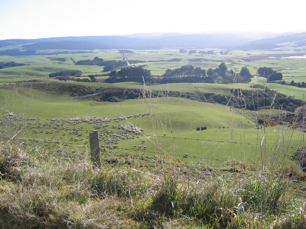
At some point in the trip—I think it might have been between Slope Point and Curio Bay, actually—we very nearly had a sheep-van pile-up, which would have been incredibly interesting for me to describe here. We were rounding a blind corner when, all of a sudden, a flock of sheep was blocking the road. The shepherd, instead of driving ahead of the sheep which I believe is the custom—if I remember my bible metaphors correctly, anyway—was dawdling behind, closing gates or something, and his sheep were tromping down the road thinking they were heading to wherever the sheep equivalent of Mecca or Shangri-La or El Dorado is (yes, I know, Mecca falls into a different class than the last two, but I typed it first so that shows proper respect). Most of us were suddenly jolted from our naps as the van . . .slowed.
I would like to say that the van shrieked to a halt or squealed to a stop or something more colorful, but, really, because the van was carrying a pretty full load and the roads necessitated us driving around 40 mph the whole time, we really weren’t going fast enough for there to be any drama to our deceleration. In fact, that’s probably the best descriptive term for what we did—abrupt deceleration.
Anyway, the trick to getting through a flock of sheep is to not stop. If you stop, like sharks in water, your vehicle and everyone in it will die and be devoured by the sheep. Or something like that, the local legend goes.
Somewhere along the way we had the distinct pleasure of seeing an honest-to-god sheep dog bolt across a pasture and single-um-pawedly round up around 100 sheep. That was also rather fun to watch—like a, I don’t know, really fast, agile, potentially dangerous . . . insect of some sort . . . flying across an open area to round up a bunch of . . . non-dangerous . . . but still group-oriented bees. . . . Hmm. That one needs some work. It was probably more like a dog darting around a pasture and sheep all swarming to one corner. But remember, sheep look like maggots from the sky—that’s an important mental image to ALWAYS keep in your mind when thinking about sheep. Trust me. It might save your life someday when you’re driving through a flock of them.
So, Porpoise Bay was the first real civilization that we had stepped into in quite awhile. We had passed through a few of the aforementioned “towns” earlier, but there weren’t what one would be possessed to call services available in any of those. In Porpoise Bay—which was decidedly free of porpoises—we found a nice snack bar/convenience store place, some public restrooms and some more nice views of the ocean and the bay itself. From the some of the paintings that decorated the walls of some of the buildings, I would wager that Porpoise Bay is a popular jumping off point for surfers, but I can’t verify that without looking it up on the internet, which I don’t feel capable of doing at this moment—I have no good reason, just that I don’t feel like learning anything at the moment. We were also told that, a few years earlier, whales had been spotted in the bay. I was very excited for the people a few years earlier who got to see that, but less excited for us since we got to see doodly (bastard! Doodly IS a word! I have never known hate like this, Spell Check. I will destroy you) squat. Then I had a cookie and a soda because it was rounding 2:00 and I hadn’t eaten anything since my morning cup of coffee. After our snack break and some more picture taking, we hit the road again, this time trying to found a town with some sort of substantial food to offer.
I should note at this point that it was a Tuesday. Normally this wouldn’t be important, as Tuesdays almost never are. But we found out in not one but two small towns, Tuesday is the day that people don’t buy things in the Catlins. Since there are no serious towns for a kajillion miles from the Catlins, rural residents have to rely on the working whims of the town dwellers, and, apparently, someone somewhere decided that Tuesdays were not meant for work because EVERYWHERE was closed. We hit a few restaurants in two relatively close cities and none of them was open, nor were any other businesses.
Then, in the town of Owaka, which was not the name of an ewok in Return of the Jedi but should have been, we found a café that had its front doors open. We quickly stopped, slid out of the van, went inside and started forming a line at the counter. It wasn’t until about fifteen minutes later, after the owner had taken our orders and started cooking our food, that any of us noticed the sign on the door that signified that he, too, was not opened on Tuesdays. We found out that we had just happened to catch him unloading a shipment and the café happened to be open for that short time. We felt a little bad, but he seemed appreciative of the business, or at least feigned politeness well, and most of us were hungry enough by that point not to care TOO much.
The café, indistinctly named Catlins Diner and Café, was unlike anything I had ever been in before for another reason, besides the fact that it was technically closed while serving me food. Attached to the café there is a hostel for backpackers. Backpackers, in New Zealand at least, are more like hitchhikers than what people in the States envision as a backpacker. In the States a backpacker is usually some gearhead who spends a fortune buying equipment just because the idea of it is really cool—and then he or she will take it out about once a year for a dusting and a couple of miles of walking in a state park before an uncomfortable night or two on the rocks.
There, apparently, backpackers wander all over the place like hippies with no VWs, and, sometimes, they like to stop at places like this to rent a bed and have a night of sleep. The hostel area, which we were able to sneak a peak into, smelled like an old, moist, butt towel and looked about as clean. The beds were sunken and, I’m pretty sure, the source of the smell. In short, I think I’d recommend the ground over the beds in this place—though they did have a TV in the “living” area they provided, which would allow a traveler to catch up on the morning news show that is pretty much ALL that’s available in every hotel we stayed in.
One other note about the café and, in fact, any restaurant that serves hamburgers—that I noticed at least—in New Zealand. Beware the New Zealand hamburger, unless you are from California, then these burgers will probably seem pretty reasonable to you weirdoes. I had two hamburgers while in New Zealand and both of them had all sorts of crazy crap on them, which is a dining disaster in my opinion. Theories as to what does and doesn’t belong on a hamburger are, of course, widely varied, and, with the exception of my own Law, wrong. The center of attention in all hamburgers should be, naturally, the burger. Anything that is added to it is meant to complement the flavor of the meat, not overpower it. Hamburgers should also never be a source of roughage. The color green should never be spotted anywhere but, perhaps, on a slice of dill pickle served next to the burger, which the diner can dutifully ignore. A proper hamburger should have the following: two buns, a burger, a single condiment—never mustard, which is the devil’s condiment and condemns eaters instantly to a circle of hell most unpleasant—and a slice of cheese if the diner chooses. That is all. At this café, the chef added what he called “salad” to the burger, which turned out to be a one-inch pile of onions and another one-inch pile of coleslaw. Even after scraping all of it off, with many select curses on the country that would tolerate such a behavior, the hamburger still tasted like the cow had been inhumanely killed by a two-story onion loaf and the buns reeked of whatever evil juice is used to make cabbage inedible in coleslaw. I was, however, starving, so I ate it anyway, pausing only briefly to continue my tirade on Hamburger Theory (which was adopted as Law by a panel of expert, consisting of me, shortly after the trip).
After lunch, and after calling to change our dinner reservation at El Tigre (where the family’s 60th birthday was being held), we headed to our last point, which was, I think, the one that made the whole trip through the Catlins worthwhile, Nugget Point. Nugget Point, we heard, had another lighthouse. It also had a walk “over a land bridge with a sheer drop to certain death on both sides,” someone, I believe John, who was always eager to ease our fears, said. Basically, we had to drive up some steep hills to arrive at the parking area, then we had to hike about a quarter mile up and down some more steep hills, then we arrived at Nugget Point.
This is actually a rather tough site to describe. The coastline in this area was, again, elevated from the surface of the water. Think Cliffs of Insanity from The Princess Bride. However, attached to these cliffs there is a land bridge, about ten feet wide (which was not nearly as scary as I was picturing it in my head—I was seeing swaying suspension bridges in my head when John was describing it) that connects the cliffs to another outcropping of land. On this outcropping there was another lighthouse. This lighthouse, unlike the first, was well worth the trip—and I wager that even the lighthouse freaks would enjoy seeing this one. The lighthouse itself probably wasn’t that special (I wouldn’t know, since my expertise on lighthouses extends only to what I learned from the movie Hysterical, and this lighthouse wasn’t haunted or nearly as big as the one in the movie was), but its location certainly was.
Nugget Point is a pleasant enough sounding name for a place punctuated by massive, jutting shards of death, which is exactly why the lighthouse needed to be built in the first place. It’s a nice, euphemistic name—like Crocodile Dundee calling his machete a “knife.” I can’t even imagine how much of a pain in the ass that lighthouse must have been to build—many of us were finding ourselves winded after the hike, and we didn’t have to carry a stack of lumber or whatever else they make lighthouses out of . . . light, I suppose, which might not be all that heavy, now that I think about it. Anyway, just off the outcropping where the lighthouse is built, there are several massive rock points spearing out of the water. It’s no wonder people decided the area probably needed a lighthouse, it certainly didn’t look like any place I would want to take a boat through, even with the full benefit of daylight vision, much less by lighthouse light.
Surprisingly, there were fences built along the land bridge and another around the scenic patio that had been built just in front of the lighthouse to allow people to see just how deadly the water below really was (again, it would have sucked hard to be the person who had to build that stuff). It might have been the safest attraction I’d been to the whole trip, and it also ranked among the most worthwhile to see while in the south island, I think. Also, if anyone is planning a suicide jump any time in the near future, I would certainly recommend Nugget Point, if you want it to look like a suicide, that is. If you want it to look like an accident, stick with Slope Point. Both of these places offer a very scenic final view and ultimate resting place, I think. Definitely worth the time and trouble it would take to get there. Maybe I should start marketing some “specialty” trips targeting that particular demographic. Could be some real money there—after all, they won’t have anything else to spend it on afterwards. Something to think about.
After Nugget Point we headed home, which took around an hour and a half. After a little time to clean up and change, we gathered at El Tigre for the final installment of 60th birthday celebrations.
El Tigre is a nice restaurant. No, El Tigre is a nice restaurant, in atmosphere, product and service, and it is handsomely reflected in the price. As both John and Sara pointed out, El Tigre was probably one of the nicest restaurants outside of Queenstown in all of the south island, and I wouldn’t be at all surprised if that was a true statement. It certainly impressed me. The menu was quite extravagant, with main courses including things like ostrich, baby chickens, veal, venison, fillet mignon and just about every type of exotic food that one might hope to find in a foreign land (no kiwi, though, or penguin, which disappointed me). And, yes, I said baby chickens. Cute, fuzzy, baby chickens. And cute, doe-eyed baby cows. This place has something against the cuter and more vulnerable of the edible species. I steered clear of those plates, because I’m not a baby killer, and decided to try the ostrich. I was a little surprised that it tasted very much like steak. I guess I shouldn’t have been surprised, though, anything that big and cantankerous couldn’t possibly taste like a chicken or other smaller bird.
Disclaimer: OK, so I can’t COMPLETELY remember if there were, in fact, baby chickens on the menu. I swear up and down that there were, but Libby can’t verify it. I will leave it up to another family member to post a reply to this to either verify or deny my claims. I’d hate to be sued by the New Zealand Anti-Defamation League, Baby Chicken Eaters Division or something for being inaccurate about this.
We ate, drank, reminisced about old family stories, and took turns enjoying what I think was the most appealing feature of the entire restaurant—the handicap bathroom. As I mentioned in an earlier post, this was far and away the nicest bathroom that I had the honor of peeing in the whole trip. It was spacious, well-decorated and had individually rolled hand towels in a basket off to the side. It was opulent and decadent. I relished every moment I was in there. I did, of course, feel a little guilty using the handicap restroom, but, as I stated in the earlier post, we were pretty much the only customers left at that point in the evening, so it wasn’t like I was depriving anyone of essential services. Plus, the other toilet was a hole in comparison.
By the time we finished eating, it was coming up on 10:00, so we decided to take the birthday cake home and eat it there, which we did, with more wine and laughter and stories. It didn’t take long after the cake for all of us to start feeling the onset of end-of-vacation blues, though.
The next day the Canadians and Libby and I were going to have to pack everything up and Jamie and Ami were heading back to the north island. Fortunately for all of you readers—or at least the ones that I have been talking to, who keep complaining “but your stories are so LONG” –things pretty much came to a screeching halt after this day. My next post will be pretty short, so you have that to look forward to.
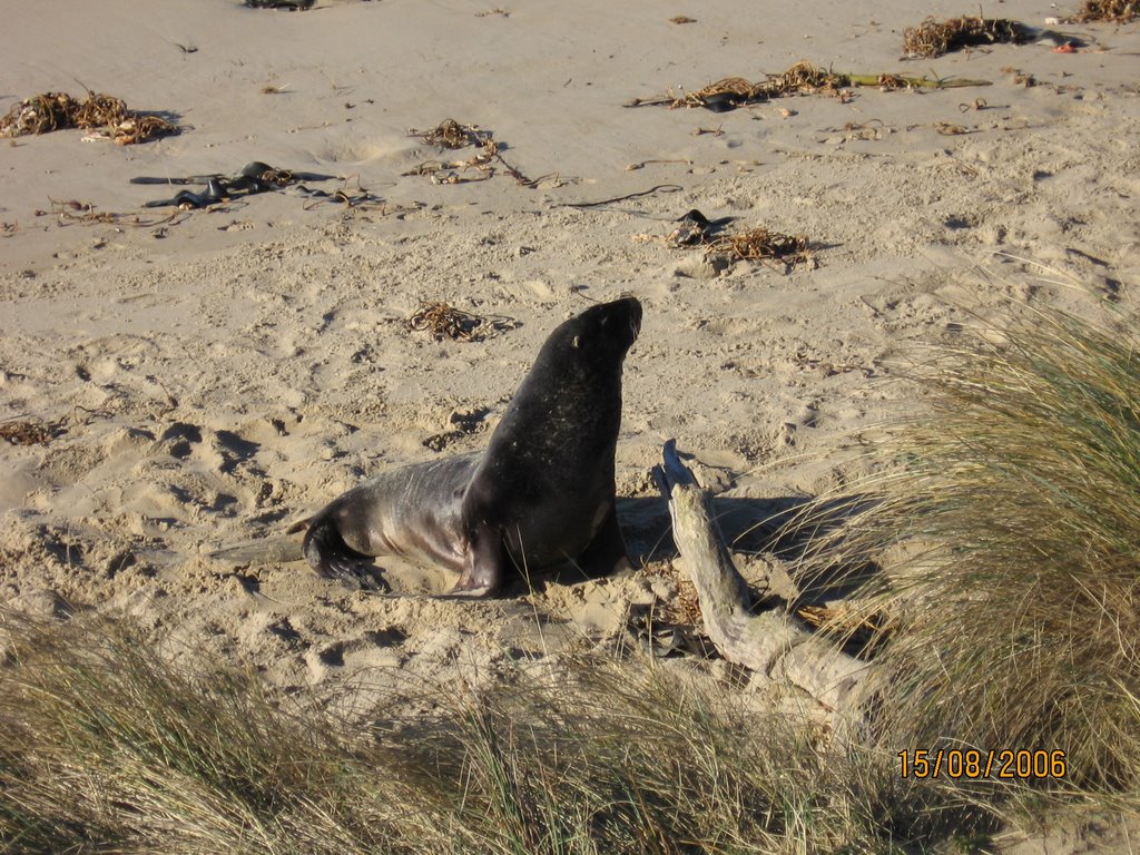 A sea lion. Notice the shape and natural posturing of the head--it would be perfect to attach a laser to.
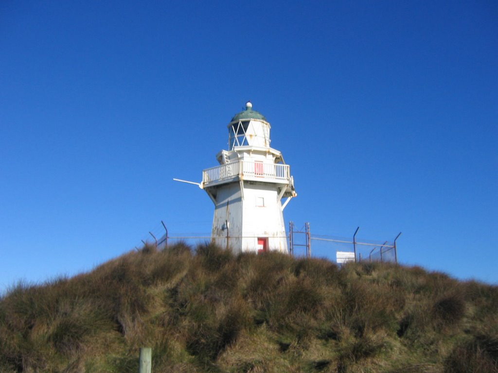
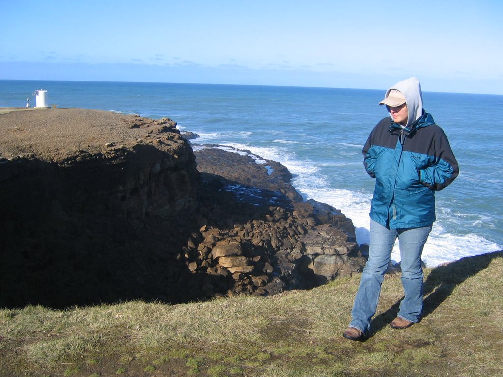
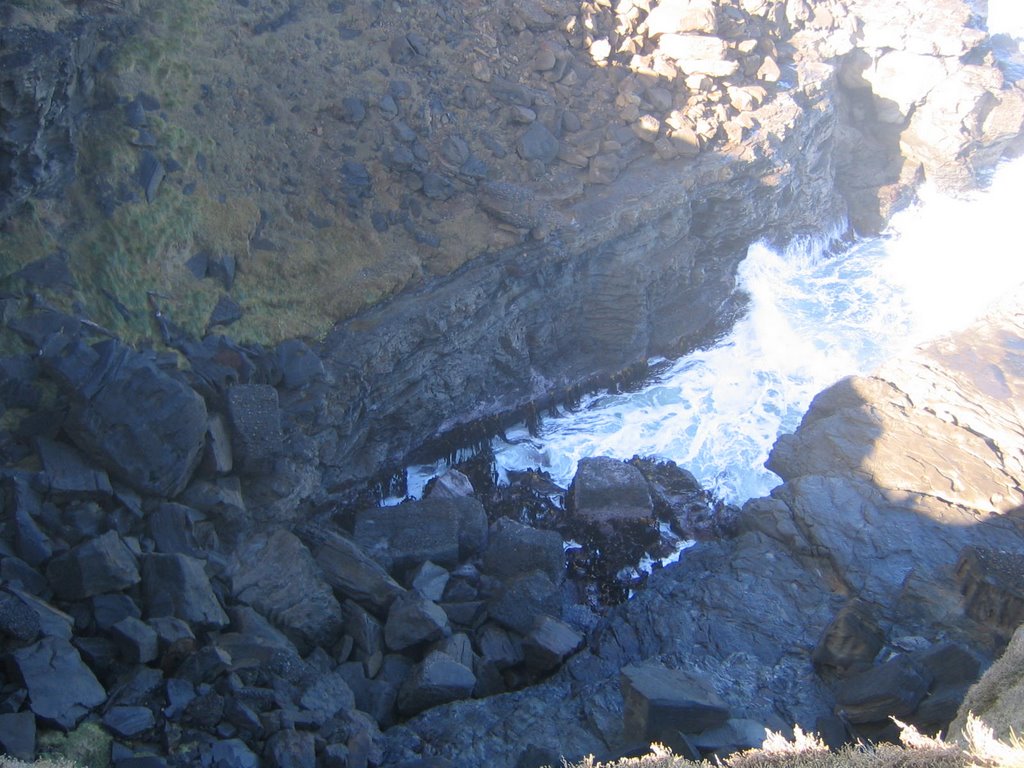 This is the drop down from where Libby was standing. Sorry if this isn't the greatest quality, I was holding the camera out in front of me, trying not to get any closer than I had to.
 The southernmost sign in New Zealand. I believe you can see the start of the fence that I peed on to the left. If you followed that back another fifteen yards or so, you'd find my marked spot.
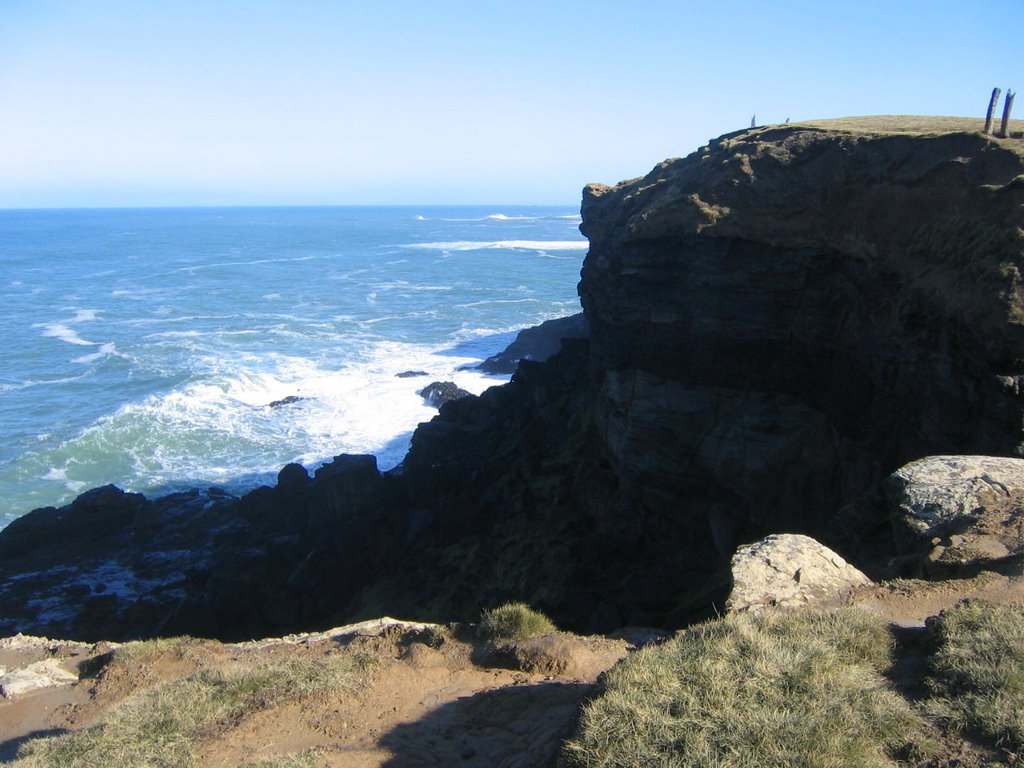 The view from the opposite side of that drop I was talking about earlier. I think this gives a little better perspective of just how high up it was. But it still doesn't do it justice.
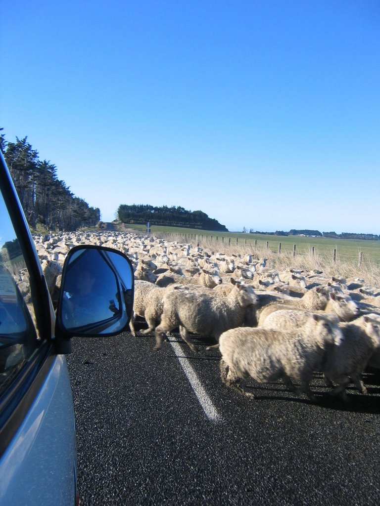 Never stop in a flock of sheep. You will die.
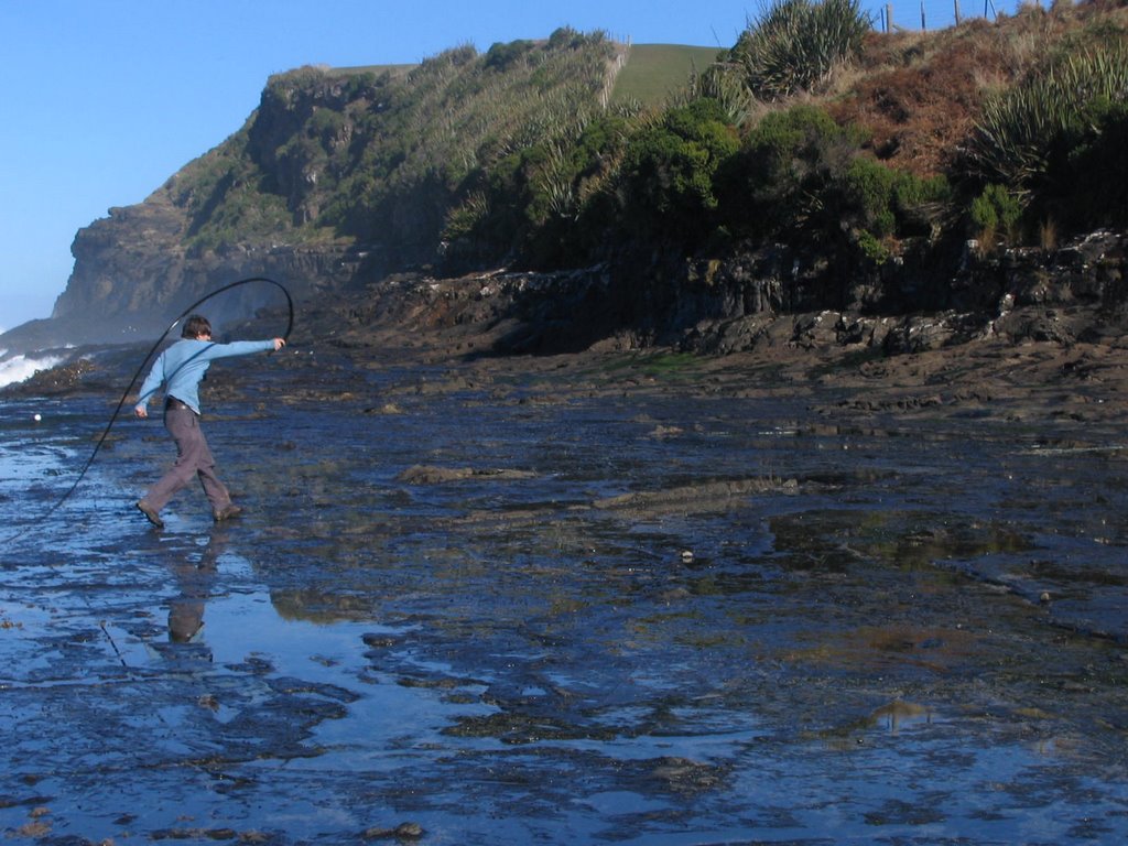 Jamie, trying to whip a sea bird of some sort--probably an albatross--with a strip of kelp.
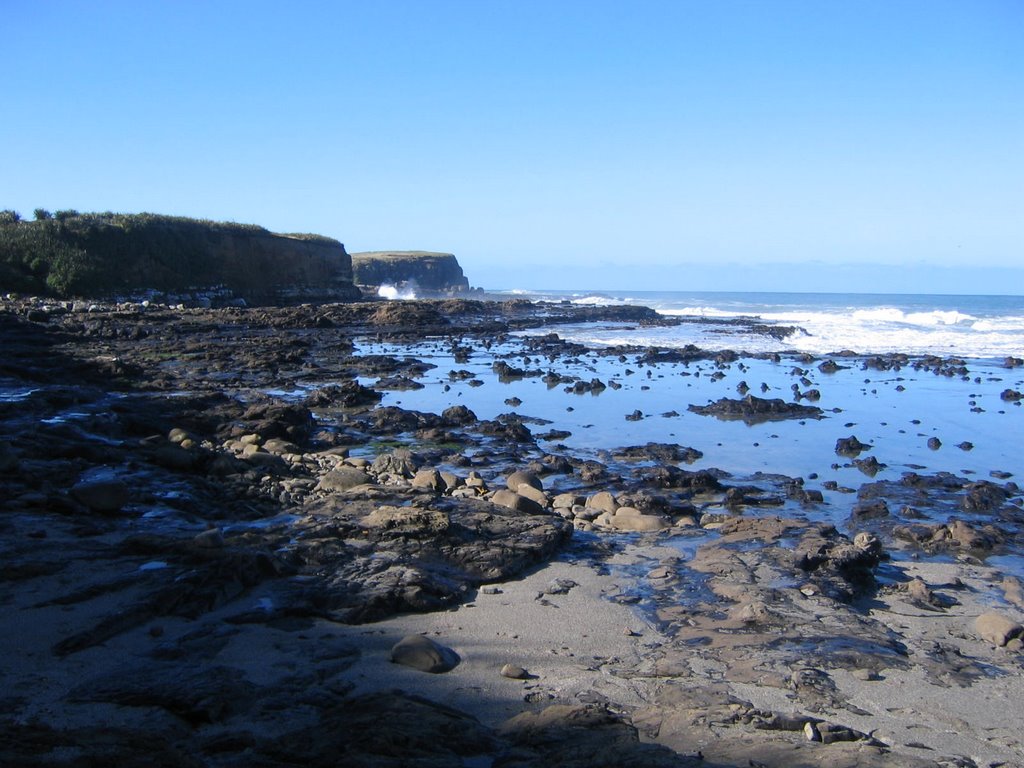 The petrified forest. Yeah, I know, not so foresty. I'm told there are strips of rocks on the beach and these are the old trees or something. Whatever. Looks like rocks to me.
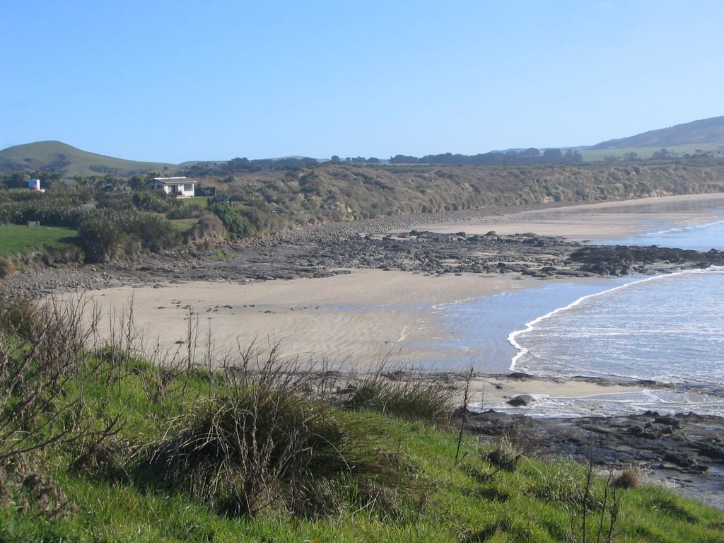 Porpoise Bay. It is a bay, but there were no porpoises. To the left of me was snack bar and picnic area that represented the only civilization we'd been in all day.
 John, looking contemplative, at Porpoise Bay. No, really he's listening to the cyst in his head. It's saying, "I swear to you, JF SAID he wanted you to push him over the edge." But John wouldn't listen. Instead, JF had to jump on his own. Very sad and tragic, except for the part where he's a French-Canadian.
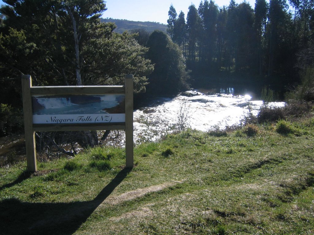 NZ's Niagara Falls. Not as impressive as the one in North America, but FAR more pleasant to visit--unless you like wax museums and carnival atmospheres, then the North American version is definitely for you.
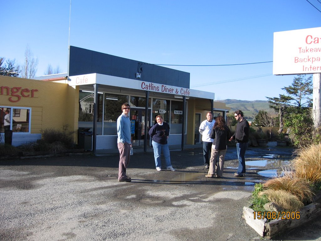 The diner in Owaka. Be sure to ask them to "hold the salad" on your burger. Trust me on this.
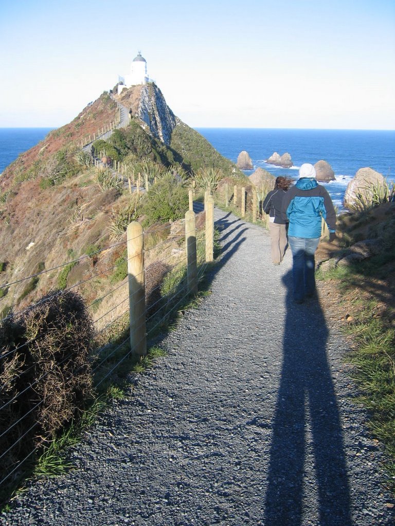 The land bridge connecting Nugget Point Lighthouse to the main body of land. Don't let the foliage fool you, the drop on the opposite side is very nearly straight down.
 The rocks out from the lighthouse on Nugget Point that probably killed a person or two. Not the most hospitable place for a sailing vessel.
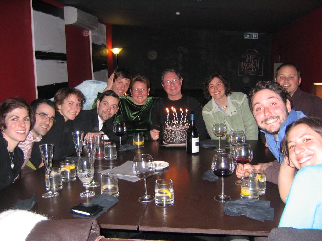 The family gathered around the table in El Tigre. Notice the cake. It weighed about three hundred pounds and was solid chocolate. They constructed it with a little known chocolate that forms on the surface of dwarf stars. Tasty but filling.